We hiked St. Mary’s Gorge trail for the fourth time. Here are some resources I put together in Google Earth and some additional helpful resources in locating the swimming hole and waterfalls on this trail.
There are many posts already written about this trail so I won’t recap them all. One important point to note: because this is national wilderness the trail is not officially blazed or marked (or marked clearly for that matter). It is stated on the trail head (which is clearly marked) of this fact and includes some additional pointers for hiking such as being appropriately dressed, having adequate gear and supplies, and having knowledge and skills of land navigation. Besides ourselves, we passed only one other group of about four groups we counted that was adequately equipped for emergencies! REF: https://www.npr.org/2017/10/25/559987030/more-americans-head-into-the-wild-unprepared-for-the-wild
The first resource is a Google Groups .KMZ file that I found that includes a topographic overlay in Google Earth. This is not my resource but one I found. It helped and was close to what I found on my own (and subsequently marked with GPS coordinates).
https://productforums.google.com/forum/#!topic/gec-travel-information/y470JYDAsPo;context-place=topicsearchin/gec-travel-information/St.$20Mary$27s$20Wilderness$20Area
In the event that the Google Groups post goes away (which happens sometimes), I have an archive of the .KMZ file here: https://www.dropbox.com/s/lqqwwi67bge7s82/Google%20Groups%20Archive-20120118172933-4f1771fd18bf89.27926718.kmz?dl=0
A well-written description of the hike can be found on this blog post: http://hikingshenandoah.blogspot.com/2013/05/saint-marys-falls.html
It is better and more accurately describes the hike then some other popular (and higher ranked) results on Google for “St. Mary’s Gorge Trail Hike”.
Finally I have this .KMZ file which drops a marker on the swimming hole and waterfalls on this trail. It is accurate within a few meters. My .KMZ file is here: https://www.dropbox.com/s/buc113jilv8n4qi/St.%20Mary%27s%20Wilderness%20-%20Gorge%20Trail.kmz?dl=0.
A Google Maps URL to the swimming location is here: https://goo.gl/maps/XkiKgSaUvAB2
A Google Maps URL to the falls location is here: (pending approval from Google).
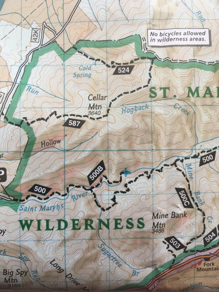
The GPS coordinates of the two locations are: 1) Swimming hole 37.9278333, -79.1080556 and 2) Waterfalls 37.929662, -79.107316. I marked the waterfalls on my paper topo map which looks like this:
Happy trails!