There is a strange little pocket of the internet where the mere mention of Philmont radio infrastructure seems to make some people bristle. So, just to get it out of the way up front: this map was built from publicly available FCC licensing data. The source is the FCC’s Universal Licensing System, which is open to the public and searchable by anyone.
But this project was never really about a database, a spreadsheet, or a KML file. It was about Philmont.
And if you happen to be the kind of person who thinks mountains, maps, repeaters, and public data all belong in the same sentence, welcome. You are among friends.
Philmont Scout Ranch has a way of getting into your system (or so I’m told. I’ll find out later this year). The scale of it. The terrain. The history. The openness. The sense that every ridge has a story attached to it. Philmont is one of those rare places where adventure, leadership, logistics, heritage, and wilderness all collide in one giant, dusty, unforgettable laboratory. For generations of Scouts and Scouters, it has been a proving ground. It is a place where young people learn that the world is bigger than they thought, and that they are capable of more than they realized.
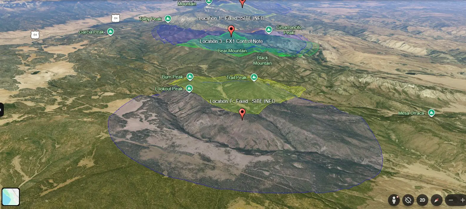
That is part of why this interested me so much. Philmont is famous for its peaks, camps, treks, and traditions. But behind every great adventure is infrastructure quietly doing its job. Water systems. Logistics. Staffing. Transportation. Communications. Power. Natural infrastructure… and man made infrastructure. Radios are part of that invisible backbone. Most people will never think much about them, and that is usually a sign that the system is doing exactly what it is supposed to do.
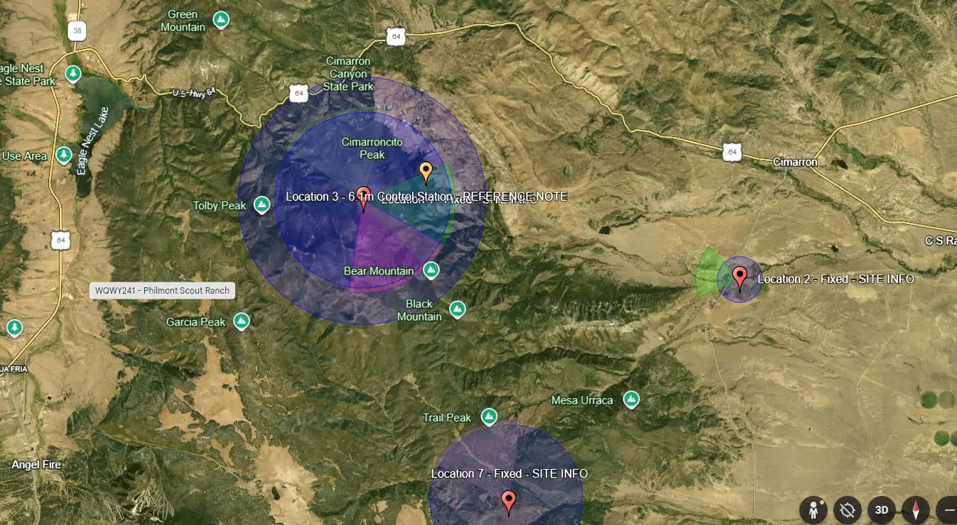
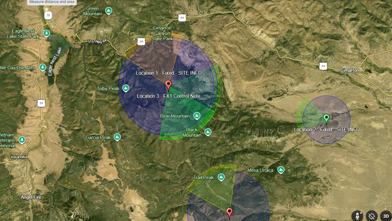
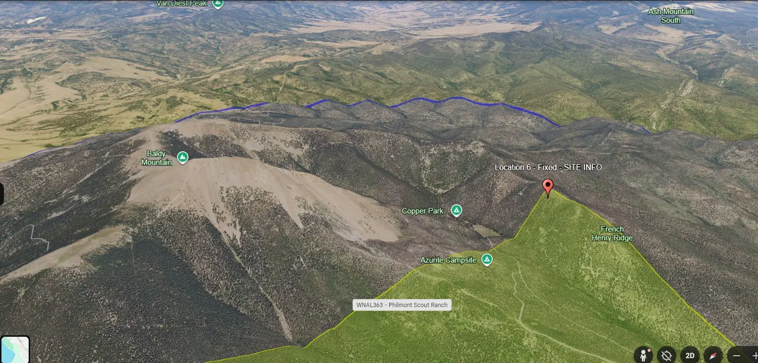
I took the licensed site and frequency information associated with Philmont Scout Ranch callsign WQWY241 and converted it into a Google Earth KML. That made it possible to visualize repeater sites, fixed locations, antenna sectors, and associated frequencies in a way that is a lot easier to understand than a wall of licensing tables and raw records.
Why do this? Because:
1) Data is beautiful.
There is something deeply satisfying about taking raw information and giving it shape. Coordinates, frequencies, antenna azimuths, beam widths, ERP, site classes. By themselves, they are just numbers. Once mapped, they start telling a story. Suddenly, what looked like a stack of sterile public records becomes something human and purposeful. You begin to see how a system was built, how it reaches across distance, and how it supports people moving through a demanding landscape.

2) Infrastructure is beautiful.
Most people never think about the systems quietly doing the hard work in the background. Radio systems are one of those things. Towers, repeaters, control links, base stations, temporary coverage areas. This is the invisible framework that helps operations function across rugged terrain, and there is real beauty in systems built with purpose. At Philmont especially, that matters. This is not a tiny property with a parking lot and a couple of sidewalks. It is a massive, complex environment where communications are part of what makes the entire experience function safely and effectively.
3) Radios are fun. Plain and simple.
That is really the heart of it. Some people like old cars. Some people like maps. I like radio systems, coverage geometry, licensing data, and the weird joy of watching infrastructure come alive on a map. Radio has always lived at that wonderful intersection of technical skill, experimentation, service, and adventure. It invites people to ask questions, to test things, to build things, and to understand how signals move across space and terrain. That spirit feels right at home in Scouting.
And that is where this starts to overlap with Radio Scouting.
Radio Scouting is one of those corners of the program that rewards curiosity. A Scout keys up a radio, makes a contact, sends a digital message, learns how repeaters work, and suddenly the world gets bigger. Radios are more than gadgets. They are tools for communication. They connect outdoor adventure to technical knowledge in a way that feels both old-school and futuristic at the same time. Philmont, with all of its scale and its sense of possibility, feels like the perfect backdrop for that kind of curiosity.
There is also something very Philmont about following a question just because it is interesting.
- What frequencies are licensed here?
- Where are the repeater sites?
- How is the system laid out?
- What does the coverage geometry suggest?
None of those questions are necessary in order to hike a trail or complete a trek. But they are exactly the kind of questions that grow naturally out of an environment that inspires wonder. Philmont has always been more than a destination. It is a place that pushes people to observe more carefully, think more deeply, and become more capable.
That, to me, is the real intersection here: Philmont, Radio Scouting, and curiosity. One is a legendary place. One is a hands-on doorway into communications and technology. The third is the spark that makes a person lean in and start exploring. Put those three things together and you get something pretty special.
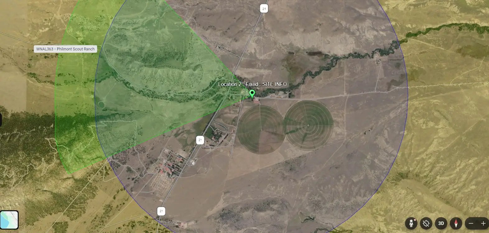
This project was simply the intersection of open data, technical infrastructure, Scouting, and genuine enthusiasm. It was a small exercise in taking public records and turning them into something visual, useful, and interesting, but it was also a reminder that there is still a lot of joy to be found in learning how things work.
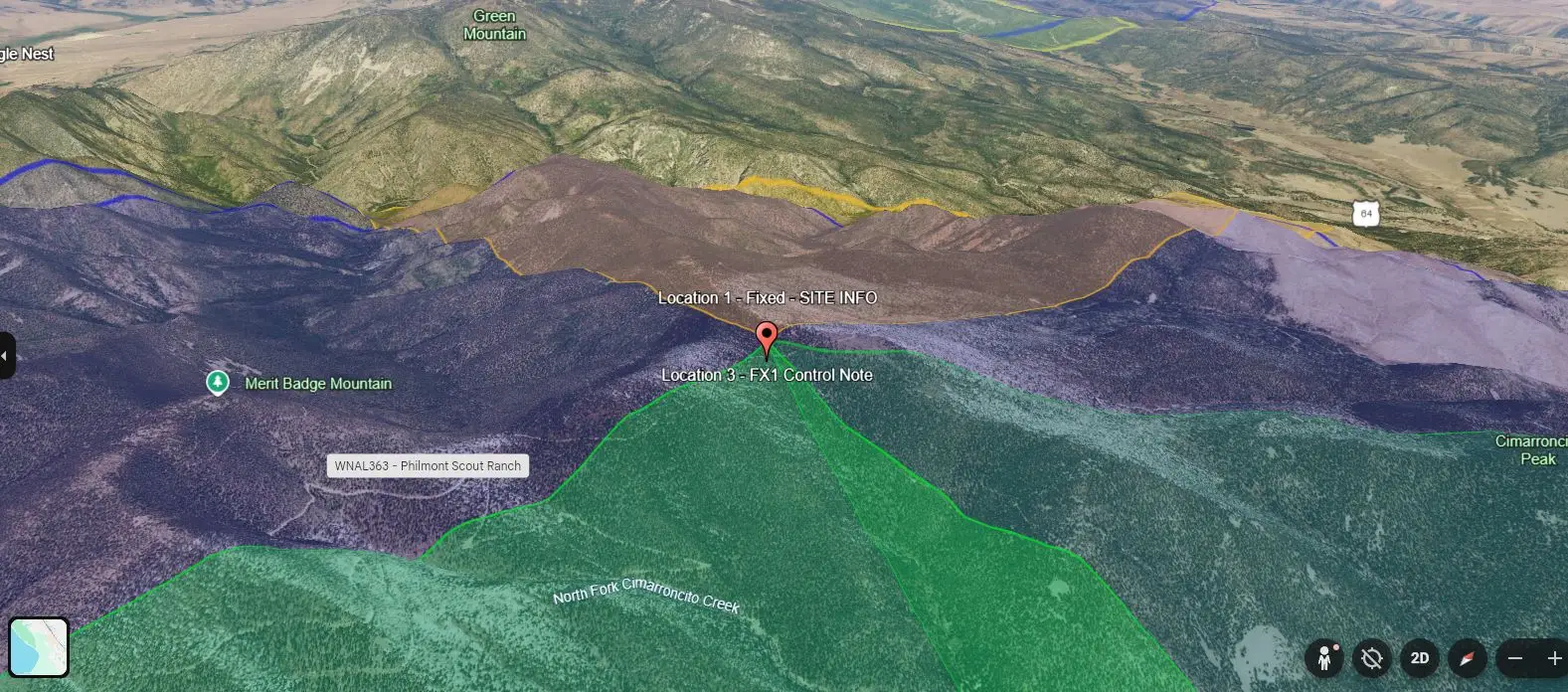
For anyone who wants to explore the source material themselves, the FCC ULS is the place to start. Search by callsign and dig into the license details, frequencies, and site information there. And if you happen to be the kind of person who thinks mountains, maps, repeaters, and public data all belong in the same sentence, welcome. You are among friends.
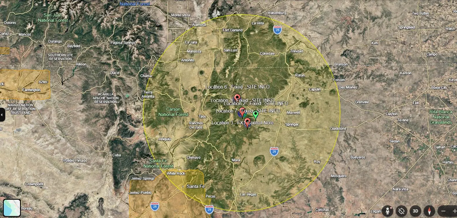
At the end of the day, this was just a fun exercise in turning public records into something visual, useful, and interesting while paying homage to a place that has inspired generations of Scouts to get outside, look closer, and keep learning.
Open data. Mountain infrastructure. Philmont. Radios. That’s my kind of art.